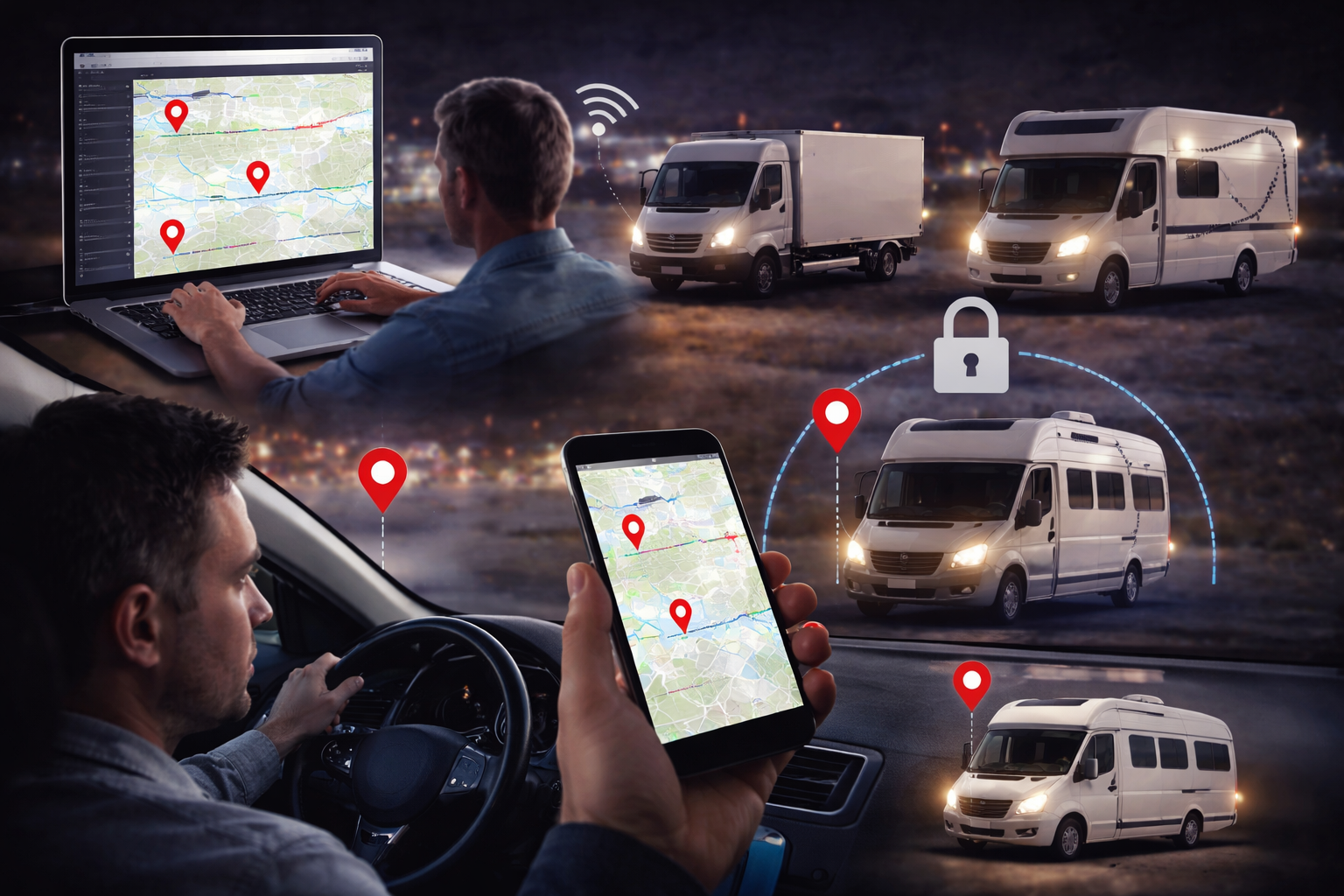
Live Tracker with Satellite View – Track Routes in Real Time
Live trackers with satellite view make it possible to follow the exact position of vehicles in real time on a high-resolution satellite map. Every turn, every junction and every stop is visible – precisely, continuously and immediately accessible. This technology is today a central tool in fleet management, logistics and professional vehicle protection.
How Does the Live Tracker with Satellite View Work?
GPS Technology as the Foundation
Every vehicle is equipped with a GPS receiver that continuously receives signals from multiple satellites simultaneously. The exact position of the vehicle is calculated from these signals – with an accuracy of up to 2 metres. Position data is updated every 2 seconds and transmitted via the mobile network to the Jumbo Ortung Horizont Online Portal.
Live Tracking Platform
The Horizont Online Portal is a web-based platform that receives all vehicle GPS data in real time and displays it clearly. The platform is accessible via any browser – on a PC in the office as well as via smartphone app while on the move. All fleet vehicles are visible on a shared map, including location, speed, direction of travel and ignition status.
Satellite View
The satellite view uses high-resolution satellite imagery to display terrain features, roads, buildings and surroundings in far greater detail than a conventional road map. Particularly in rural areas, on building sites or in complex terrain, the satellite view offers decisive advantages when assessing vehicle positions and routes. The portal allows switching between map view and satellite view with a single click.
Who Has Access to the Live Tracking Platform?
The Horizont Online Portal operates with tiered access rights. Administrators can see all vehicles and all functions. Individual drivers can be given their own login – with restricted rights, so they can view their own trips but cannot change administrative settings. All access is logged and data privacy is maintained at all times.
Additional Features of the Live Tracker
Beyond the basic location display in satellite view, the system offers a range of further functions:
- Route history – all driven routes are stored for up to 18 months and retrievable at any time
- Speed monitoring – violations are automatically recorded and logged
- Route deviation alerts – immediate notification if a vehicle leaves the planned route
- Geofencing – define virtual zones and trigger alerts on entry or exit
- Movement alerts – notification if a vehicle moves outside operating hours
- Daily reports – automatic summary of all trips, standstill times and kilometres per vehicle
- Driving behaviour analysis – braking behaviour, idling times and driving style are evaluated
Use Cases for the Live Tracker with Satellite View
The combination of real-time GPS and satellite view is particularly valuable in the following areas:
Fleet management – dispatchers keep all vehicles in view at a glance, can adjust routes in real time and communicate accurate arrival times to customers.
Logistics and delivery – delivery status is traceable at any moment; delays caused by traffic or detours are immediately identified and can be communicated proactively.
Building sites and construction machinery – in complex terrain, the satellite view shows the exact location of machinery and vehicles, even away from surfaced roads.
Theft protection – in the event of theft, the exact location of the vehicle can be tracked on the satellite map in real time and shared with the relevant authorities.
Conclusion: Live Tracker with Satellite View – Maximum Transparency for Your Fleet
The GPS live tracker with satellite view from Jumbo Ortung gives you full control over your vehicles – with real-time position data, high-resolution satellite view, route history and comprehensive alert functions. Whether a single vehicle or a large fleet, whether car, truck or construction machinery – the system adapts to your requirements.
Have questions? Give us a call: